KINEXON Glossary
Real-Time Locating System (RTLS): What It Is and How It Works
An in-depth glossary entry explaining Real-Time Locating Systems (RTLS), from their technical definition to how the technology works.
What is RTLS?
RTLS, meaning Real-Time Location System and sometimes also referred to as RTLS systems, is a key technology for the automated localization and tracking of objects in real time, usually within a specific business area, e.g. industrial production or warehouse. Combining wireless communication, localization algorithms and centralized monitoring, RTLS system provides:
How does RTLS work?
A RTLS system typically uses radio frequency signals such as BLE, GPS, RFID, UWB or WiFi technology to locate assets in a defined area. Each asset to be tracked is equipped with a sensor that emits radio signals. These signals are collected by a series of receivers located throughout the monitoring area. The receivers triangulate incoming signals to determine the exact location of each object using localization algorithms. Depending on business requirements, the position of each tagged object can be precisely calculated.
RTLS Tracking With Bluetooth/BLE, GPS, RFID, UWB, WiFi
Various technologies are available to enable effective communication between hardware and software components in industrial RTLS tracking systems, depending on the specific requirements. Whether a technology is suitable for a particular application essentially depends on whether objects need to be tracked continuously or just from time to time, whether this process needs to be automated and how accurate the localisation needs to be.

BLE
offers low-power communication over short distances and is usually used indoors. It is very suitable for frequent updates without reducing battery life and is therefore suitable for warehouses and factories.

GPS
enables accurate tracking outdoors using satellite signals. It is particularly suitable for monitoring vehicles and shipments in large areas, but is less effective indoors due to signal obstructions.
_11zon.webp)
RFID
uses electromagnetic fields to track tags on objects. Active RFID tags have their own power source for communication over longer distances, while passive tags rely on signals from connected readers.

UWB
provides high-precision indoor tracking with high accuracy. Its wide frequency range minimizes interference, thus making it the ideal choice for manufacturing, asset tracking and automatic vehicle navigation.
WiFi
uses existing WiFi infrastructure to track devices and assets. It offers a good balance between accuracy and cost and is suitable for industrial environments with extensive, seamless WiFi coverage.
Ultra-Wideband (UWB): One of the Most Widely Used RTLS Localisation Technologies
UWB combines short light-speed pulses and accurately measures signal arrival time over a wide bandwidth for high-precision transmitter positioning, reaching distances of up to 200 meters in line-of-sight. There are various methods available to achieve this, which differ in their accuracy, energy consumption and suitability in fast environments with a large number of assets to be tracked. The most common methods are presented here.
TWR, TDoA, PDoA, AoA Definition
Modern real-time positioning systems combine multiple localization technologies to deliver high-precision tracking in industrial environments.
.avif)
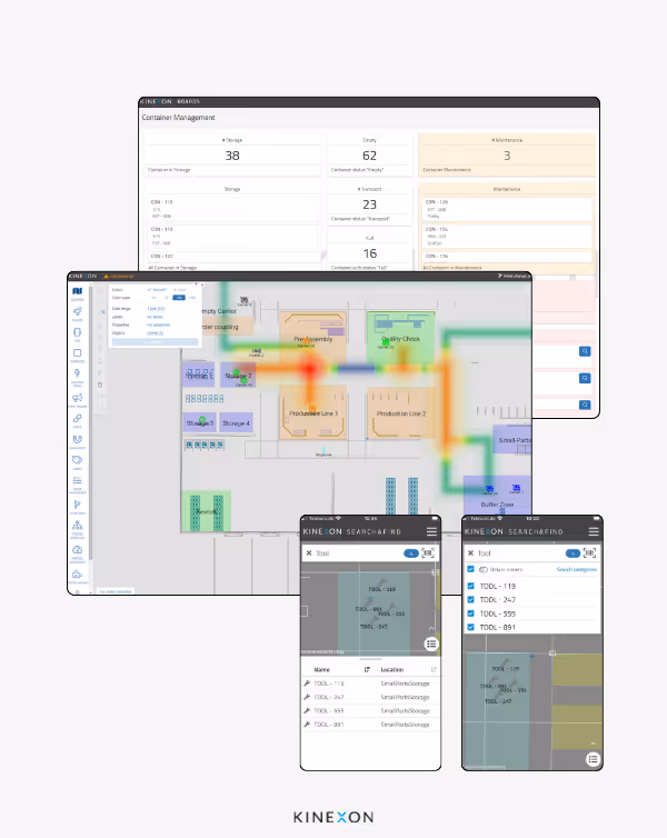
RTLS Hardware: Tags and Anchors
The hardware components of an industrial RTLS include tags and anchors - mobile devices attached to assets to be tracked that transmit signals and static ones that receive these signals, determine real-time positioning of assets and forward them for processing.
RTLS Software: Control Center and Coordinator
While hardware, anchors and tags, is an essential component of RTLS systems, any smart solution requires powerful software to unlock the true value of location-based process automation - regardless of the technology used to generate real-time location data. A sophisticated RTLS software platform integrates tracking technologies and location data, enabling operators and decision makers alike to automate operations and gain actionable insights from location data.
In Sum
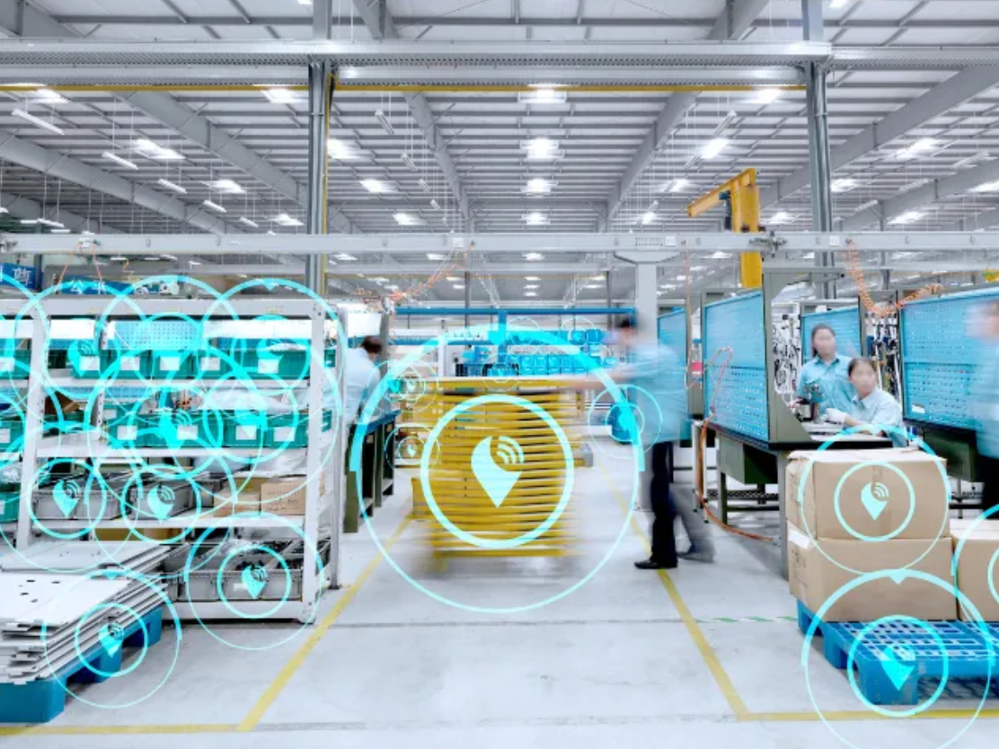
Tracking mobile and stationary assets such as manufactured goods, transport vehicles, machines, tools or containers is a key prerequisite for the automation and optimization of logistics and production processes in Industry 4.0. To reliably orchestrate complex operations in these industrial environments, the location and status of involved objects must be continuously tracked. Real-Time Locating Systems (RTLS) consisting of sensors, receivers, network and control systems provide the technical infrastructure for automated, continuous monitoring.

KINEXON RTLS Pro
Wired with superior accuracy - best for real-time automation use cases
This high performance real-time location system excels in large-scale industrial settings, delivering a superior position update rate. The outstanding tracking accuracy enables automation in order tracking and process management as well as the assembly, where high accuracy and real-time updates are essential.

KINEXON RTLS Mesh
Wireless and fast set-up, great accuracy - best for most asset tracking use cases
KINEXON RTLS Mesh offers a straightforward plug-and-play location system for industrial asset tracking, ensuring easy deployment across environments. Its flexibility spans both indoor and outdoor industrial asset management, requiring minimal setup. As a cost-effective option for businesses, RTLS Mesh simplifies asset connectivity, paving the way for efficient operations.

KINEXON RTLS Also Enables Outdoor Applications
Unlock Seamless Tracking: Extend Existing RTLS Indoor Installations and Discover New Outdoor Use Cases
A new EU-wide regulation now permits the use of ultra-wideband (UWB) technology in outdoor areas. Renowned for its precision, speed, and reliability in complex and space-sensitive indoor environments, UWB can now extend its strengths outdoors. Discover more about how this advancement ensures seamless tracking of orders and production processes and enables new use cases for outdoor asset tracking.
Learn More About Real-Time Location Systems and How They Help Drive Digital Transformation

RTLS Whitepaper
Explore the essential features of process automation with real-time location systems. Learn the basic principles and benefits of location-based process automation (LPA).

RTLS Case Study - BMW
Learn how BMW leveraged KINEXON OS and RTLS to reach a new level of efficiency intheir manufacturing operations. The results? $10+ million in savings each year.
More Resources
Stay Up to Date
Subscribe to our newsletter and stay connected. You can unsubscribe at any time.
Ready to automate your industrial operations?
Schedule a meeting with our experts to connect and automate your operations.
Get in touch